New Methods
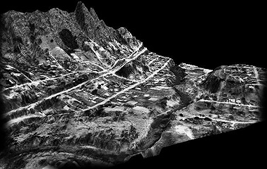
In the heart of southwestern Virginia, in the shadow of the Appalachian Mountains, a small aerial mapping firm is making a big impression through its use of 3D digital orthophotography. Tuck Engineering, Inc. is a team of Civil Engineers, Land Surveyors and Photogrammerists providing digital aerial mapping as well as traditional surveying and civil engineering.